See: GEOS-9016 issue
UPDATE: this if fixed in 2.14.1 and newer! Just for reference I add an image from the problem below the live Leaflet map.
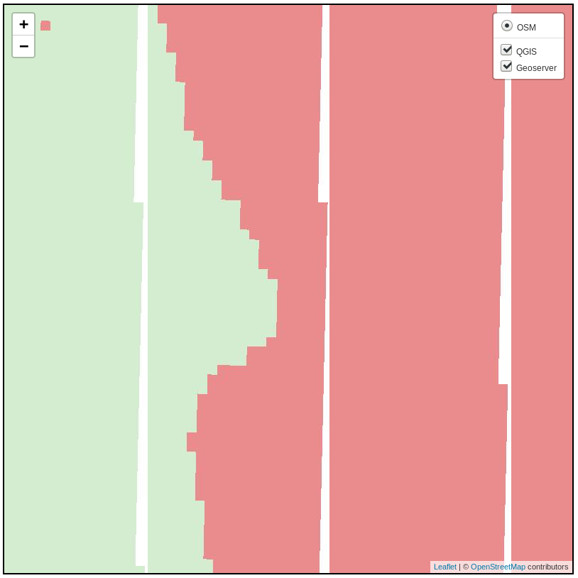
Demo to show reprojection border artifacts when a rather big tif nl28992.tif (200Mb) raster in EPSG:28992 (Amersfoort/RD New) is reprojected to EPSG:3857 (Google mercator). NOTE: if viewed in 28992 there is no problem!
This demo uses Leaflet tiled wms, to show the white stripes shown in the Geoserver layer are on every image. When this WMS layer is loaded in QGIS, and viewed at about 1:1000 you will also see it on the right of the MapCanvas.
Both Geoserver (2.14.0) and QGIS server (3.5.0) are live serving the above random values tif (slightly different styles).
THIS (below) was the problem: